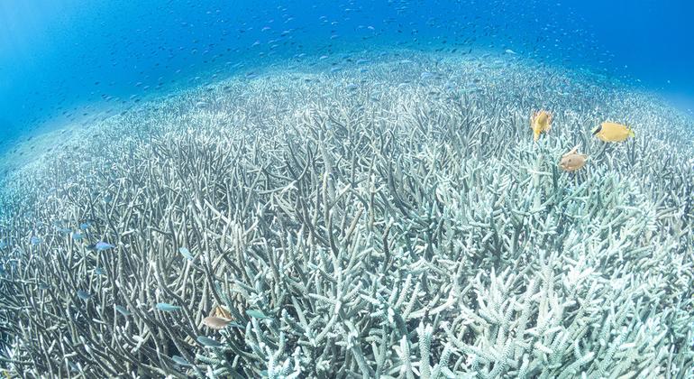
The planet's oceans recorded their highest surface temperatures ever observed for July, amid a boreal summer marked by persistent heat waves, droughts, forest fires and, at the other extreme, torrential rains and floods.
At the same time, July 2026 was, tied with 2024, the second warmest July on record globally, with an average temperature 1,47°C above the pre-industrial level, according to data from the Copernicus Climate Change Service released this Tuesday by the World Meteorological Organization ( WMO ).
The heat is not limited to the Earth's surface. During the first half of the year, approximately 82% of the world's oceans experienced marine heatwave conditions of varying intensity , the second largest extent observed after 2024.
In July, temperatures were exceptionally high across large areas of the tropical Pacific, while the Atlantic off Europe and the western Mediterranean recorded strong or severe marine heat waves.
A warmer world changes the starting point
According to the WMO, the extremes observed during the last few months are due to a combination of long-term warming caused by climate change and persistent weather patterns.
John Kennedy, the World Meteorological Organization's climate information officer, explained that a succession of high and low pressure systems has persisted around the Northern Hemisphere. High pressure areas typically bring high temperatures and dry conditions, while low pressure areas bring cooler and wetter conditions.
These systems can remain virtually locked in place for days or even weeks. In June, high pressure and the associated heat simultaneously affected Western Europe, North America, and Central Asia. During July and early August, similar patterns persisted in these regions and also reached parts of East Asia.
But climate change is altering the conditions under which these weather phenomena operate.
Kennedy compared the current situation to June 1976 , when a similar distribution of high and low pressure systems occurred. Back then, he explained, there were some exceptionally warm areas within a much colder world. In 2026, the situation has practically reversed : high temperatures predominate, and only a few relatively cool areas remain.
“Due to long-term warming, cooler areas are no longer as cool as they would have been in the past, and warmer areas are warmer,” he explained.
This warming also means that extreme heat is increasing in frequency, intensity, and duration , and is affecting increasingly larger areas.
“ And that pattern will continue in the future as long as greenhouse gases continue to accumulate in the atmosphere ,” Kennedy said, citing the findings of the Intergovernmental Panel on Climate Change.
The ocean also contributes to the heat on land.
Exceptionally high sea temperatures can, in turn, contribute to intensifying the heat in coastal areas.
The WMO noted that the Mediterranean and waters west of Europe have been exceptionally warm. These marine heatwaves contribute an additional level of warming upon which high-pressure systems act.
This is compounded by the lack of moisture in the soil. When the ground is moist, some of the available energy is used to evaporate water; when it dries out, the surface and the air can heat up more easily.
This combination helps explain the successive heat waves affecting Western Europe, where some countries are already experiencing their fourth since May.
France is forecasting temperatures above 35°C across much of the country this week, Switzerland has issued warnings for similar values, and temperatures in southern England could reach 36°C.
Exceptional temperatures and new records have also been recorded in Japan, the Republic of Korea, other parts of Asia, the Middle East and Latin America.
Drought, low rivers and fires
The heat is also occurring over territories that in many cases have accumulated months of lack of rainfall.
In Western Europe, the dryness observed since March has continued or intensified , with exceptionally low levels of rainfall or soil moisture in France, Spain, parts of Germany and the United Kingdom.
The flow rates of several major rivers are also well below normal, including the Seine, the Rhine and the Danube, with consequences for water supply, irrigation, transport and energy production.
In some areas, the deficit is so large that a summer storm would not be enough to reverse it, the WMO warned.
In northwestern and southeastern Europe, including parts of Hungary, Serbia, and the Adriatic region, an additional 250 to 350 millimeters of rain would be needed to normalize the surface water deficit accumulated since April. Even if rainfall were to return to normal levels immediately, recovery would take time.
The heat and dryness are also contributing to an exceptional fire season.
In France, emissions from fires so far in 2026 are comparable to or higher than those recorded during the extreme years of 2022 and 2023, and the country could end up experiencing one of its most severe fire seasons in the last two decades.
In Spain, emissions associated with fires are well above the average for this time of year, while numerous fires also remain active in the United States and Canada.
It's not all about the heat.
While some regions suffer from heat and drought, others face extreme rainfall.
Parts of West Africa are experiencing heavy monsoon rainfall and flooding, while the WMO has warned of the risk of very heavy rainfall, flash floods and landslides in India, Pakistan, Nepal, Bangladesh, Bhutan, Myanmar and parts of Southeast Asia.
Dozens of people have died from monsoon floods in India, while China mobilized emergency teams and carried out mass evacuations ahead of Typhoon Dolphin.
For the WMO, this succession of extreme events once again demonstrates the need to improve forecasts and early warning systems to reduce human losses and economic impacts.
What role does El Niño play?
Although El Niño is already established in the Pacific and is usually associated with higher global temperatures, the WMO stressed that there is no clear link between that phenomenon and the heat that Western Europe is experiencing this summer.
Its immediate effects are concentrated mainly in the tropical Pacific and nearby regions, while its influence on Europe usually becomes more visible later, during the autumn or winter.
The main backdrop to the current heat continues to be the warming caused by climate change , combined with persistent weather patterns.
“There are very few areas that haven’t warmed up steadily,” Kennedy explained. “That’s combining with the weather patterns we’re seeing. It’s those two things together that are giving us this record heat.”
El Niño, however, could add even more heat to the global climate system in the coming months. The WMO explained that the peak in global temperatures associated with the phenomenon usually occurs after El Niño reaches its own peak, typically between November and January.